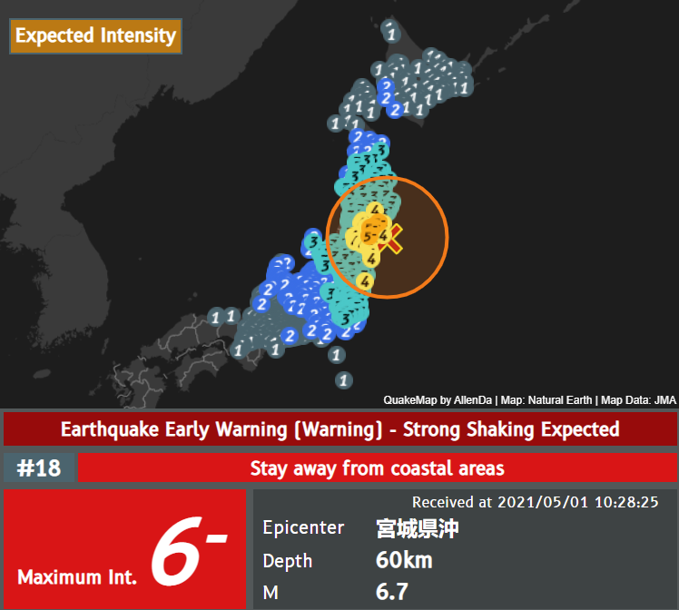
Earthquake Map
Displays information related to earthquakes, such as detailed seismic intensity, magnitude, epicenter, etc.
The currently available information categories are:
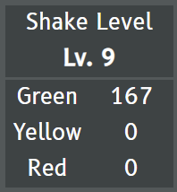
Shake Level
Displays the current shake level.
The shake level (Lv.) explanation table is as follows:
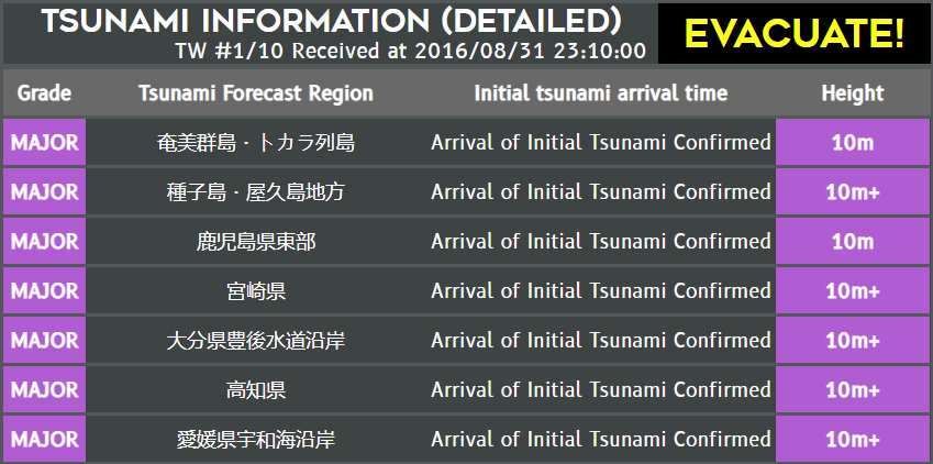
Tsunami Information
Displays the current tsunami information, including level, region name, height, and arrival time.
Details are as follows:
Note: Arrival times are estimated tsunami arrival times, not actual observed times.
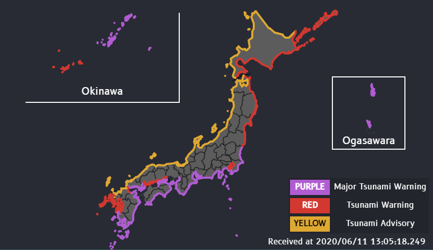
Tsunami Map
Displays the current tsunami map.
The color table is as follows:
Can sweep away most concrete and wooden houses, and destroy all facilities.
Can sweep away most wooden houses and destroy most facilities.
Be aware of possible tsunami-related damage.
Note: Okinawa and the Ogasawara Islands will be automatically hidden if the tsunami information does not apply to them.
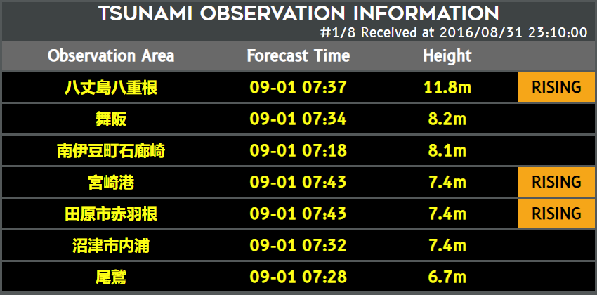
Tsunami Observation
Displays observed tsunami heights, including observation area, time, height, and whether the wave is rising.
Details are as follows:
Most houses washed away; communications largely destroyed.
Some houses washed away; communications restricted.
Pay attention to upcoming information.
Follow information from other stations.
Pay attention to upcoming information.
Pay attention to upcoming information.